29 October 2014
Overnight we had gotten a pretty good rainstorm. The upper helm door has a small leak that we put a tub and a towel under to catch the rain. I had remembered to do that, but what I had missed was the door was not fully locked. So in the morning I had a sopping wet towel and a ½ full tub. Sigh
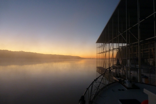
We waited for the wispy fog to rise off the river and then shoved off about 8:40AM. There is very little current and we are running with it.
We went through Pickwick lake which looks like Canada with all the cottages and boat docks surrounding it. There is an island to one side that we could see fishermen on the back corner trying their luck.
We passed the tow “Sportster” pushing two barges. Couldn’t raise the Captain, but the mate gave us a friendly wave as we drove by.
Next was the “Divide Cut”. It is a 25 mile long canal that took 6 years to dig by 7 different contractors. It is one of the Army Core of Engineer’s largest projects. It has a number of straight sections, but also has a number of turns in it to help slow the water flow during storms. Streams that come in from the side come down sluices that have concrete blocks in them. Picture a giant Pachinko machine with water bouncing from brick to brick slowing the passage rate and smoothing the flow out.
We only saw one other boat, a sail boat from Hawaii. He had it shipped to the upper part of the Mississippi and was heading down to Florida.
The Divide Cut enters into Bay Springs, what had been a small lake in the 50′s became a pretty big lake in the 60′s when the Bay Springs Lock (now called the Jamie Whitten Lock) had dammed up the river.
Just about 1 PM we docked at Bay Springs marina and had lunch.
After lunch Susan started cutting out the rest of the fabric for the quilt that she is making. I headed off to wash the towels from last night and to see the Bay Springs Visitor Center.
The center showcase is a 25′ long diorama of the Tenn-Tom waterway from Yellow Creek to Demopilis. It shows how the watershed now looks and talks about the dams that were created. It’s primary purpose was to reduce the amount of time to move goods into the Gulf of Mexico. For goods coming from Chattanooga, it reduces the trip from over 1000 miles going down the Mississippi by 400 miles. There are a number of companies that have barge facilities along the path, but the biggest winner was the residents of the area, they picked up 16 million acres of lakes and lots of shoreline for water based recreation.
The government when it bought the land also purchased land on both sides so there are a number of large state parks for hunting and camping.
The nearest town is Tupelo MS, about 35 miles away. While I had the marina van, I felt guilty about driving that far. But I did take a short detour to Natchez Trace. The Natchez Trace Parkway is a 444-mile trip through exceptional scenery and is the route that the Indians and early settlers took to get from Northern Tennessee to Tupelo MS. It’s now mostly paved and restricted to car traffic only. I took it for about 8 miles and marveled at the deep wilderness it was cutting through.
When I got back the Day-Lea-”G” II was docked in front of us. We had seen and chatted with them a few times. The Admiral had helped us dock at night at the Pickwick State Park.
Later on the crew of Elbrenda came over in their dink. They are residents of the marina. We chatted for awhile and they gave us the tip that it would be foggy in the morning and that it would be foggy for longer going down so be careful when leaving. A great tip! We were also told to ask for Cecil the lock master and pass on their regards.
Dinner was chicken and zucchini noodles and the baked potato left over from last nights dinner. It was very good, Susan makes some great dinners on the boat. The chicken had been cooked in a mushroom gravy that gave it lots of richness.
Tomorrow hopefully will be an easy day with three locks and 20 miles. Hope we get our lock karma back.